 Winter sucks in the Midwest, you don’t have to tell me – I know. Every section of the U.S. has its one bad season, it happens. The thing you need to do is relocate, temporarily. Well, as temporarily as you can afford but for the bouldering adventurer, 4-days are all you need.
 Arizona is known for quite a few things, one of them is its fantastic winters. Even up though late spring the weather is mild during the day and at night will still require a sleeping bag or blanket for those who like to rough-it. I’d recommend something light, like a Northwestern Mountaineering. The reason I’m kicking you on this light-diet, is because where we are going, water is very difficult to find. Water is also very heavy. For 2-days in the high desert, bouldering, you will need 10L at least. That’s just over 2 gallons and if a gallon weighs roughly 9 pounds well, the math is on you.

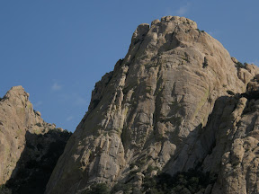
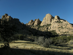
Another thing Arizona is known for is its abundance of bouldering, mountaineering, and rock-climbing spots. The place we are headed immersed in history. It sheltered the Chiricahua Apache during times of raids and war. Cochise, the great Chiricahua Apache chief rests here buried overlooking his mighty stronghold. The Cochise stronghold is picturesque rocky area located in the middle region of the Dragoon Mountains. The mighty peaks stand out in the skyline like giant rock tombstones. Seeing the way boulders here rest, will remind you of picking out shapes in the clouds. The Clanton gang held up in the northern part of these mountains hiding gold and plotting their next train robbery. There are old U.S. Army camps and mines scattered throughout this entire range. Not only home to legend but to some of the best bouldering and rock-climbing in the Southwest.
 The Sheep’s Head marks the southern point of the stronghold. Its crest starts at 5,800ft peaking out at just over 6,500ft. I set out for 2-days to summit the Sheep’s Head dome. Contemplating the weight of water is difficult until you are carrying it for a couple miles over very rough country. The elevation of where I was dropped was right at 5,200ft: which is numerals an all uphill journey. I was pleased to find a nice camp spot in some cedar trees right at the base of the dome.
 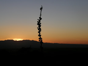 It was in the early afternoon when I finished setting up camp and I decided that I’d do some bouldering around the area to warm up for my dome summit the next morning. The bouldering here is magnificent and with the sunny high 70 degree weather it really makes you want to just pull up and move here. Climbing up the nearby peaks really gives you respect for the natives that used to call this place home. With the sun going down in an explosion of dark reds and orange I thought about the next day’s climb.
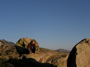
 With zero-hour upon me I ate a hearty breakfast. I knew I’d need the fuel if I was to find my way to the top carrying 3-liters of water, snacks, the camera, etc. I set out and passed some technical climbers that were prepping to go up the face. I approached the dome from the front and found a way up free-bouldering its right side. The climb to the Sheep’s Head summit took me roughly 3 hours. The view from the top was spectacular and so was the wind. The calm sunny day had become windy and overcast by the time I reached the top but the cooler weather was appreciated after the difficult climb.

Directions and whatnot
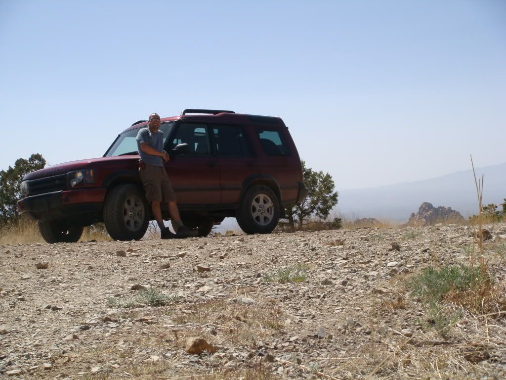
 Access is to the stronghold can only be accomplished in 4wd or on foot. As you see the sign marking the National Forrest, on your left is a cattle guard and a road heading toward the tall rocky peaks. There are a lot of unmarked dirt roads here as you go over the cattle guard try and keep right toward the Sheep’s Head.
Remember: Let not the present leave the trash for the future to clean from the past
If you'd like to see more pics, visit my web album at: http://picasaweb.google.com/LJoChavo
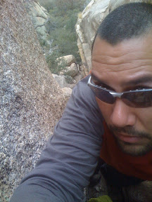
Special Thanks To: Jigga, for taking such spectacular pics and putting up with my fast pace. Donnie, no trip would be the same w/o u!